Day 2 (July 10, 2021): The Remarkable 'Heel' of Newfoundland
Today was supposed to be a wind and rain-swept day in western Newfoundland, as the remnants of Tropical Storm Elsa moved through. There were even flash flood warnings. But when we checked out of the Glynmill Inn at 10AM, after a wonderful breakfast, things were still dry.
The plan for today was to drive to Port aux Basques, the very bottom left 'heel' of Newfoundland, best-known as the ferry terminus on the Nova Scotia-Newfoundland run, and to visit a few clusters of villages on the West Coast enroute.
We headed 45 minutes south of Corner Brook to our first stop: Barachois Pond Provincial Park. (Read the captions below for details on why this park figures importantly into David's childhood.) Continuing south from Barachois, the on-and-off drizzle finally started, leading us to largely flip tomorrow's sightseeing plan with that of today, so as to avail ourselves of some less rainy places.
We rolled into Port aux Basques at 2:30PM and were tempted by a once-per-vacation treat: Mary Brown's Famous Chicken (a Newfoundland icon). After checking into our hotel near the Marine Atlantic ferry terminal, we headed east on Route 470 to see the well-known stone lighthouse at Rose Blanche.
470 extends 45km along the South Coast, passing several small villages on one side, and seemingly endless barrens on the other. Rivers, marshes, bogs, treeless hills, granite and rugged coastline comprise the topography. It leaves a person with an overwhelming sense of how vast, varied and stunningly beautiful Newfoundland is, unlike any other place we have ever seen.
By 6PM we were back in Port aux Basques, where we experienced a very odd dinner. Picture yourself in an empty dining room, where the waitress literally parks herself at your table for 1½ hours (including while you eat) and without being prompted or prodded, tells you everything about herself, including details you would never want to know. There was no escape. We left mentally exhausted, feeling like we had just spent 90 minutes in the Twilight Zone. These are the things memories are made of!
Good night from Port aux Basques.

The entrance to Barachois Pond Provincial Park (above) and Barachois Pond and accompanying mountains (below). In 1980, David and his dad camped here. The loneliness of the place was such that it imbedded itself on them both, and it has never been forgotten. This was David's first time returning there since 1980.

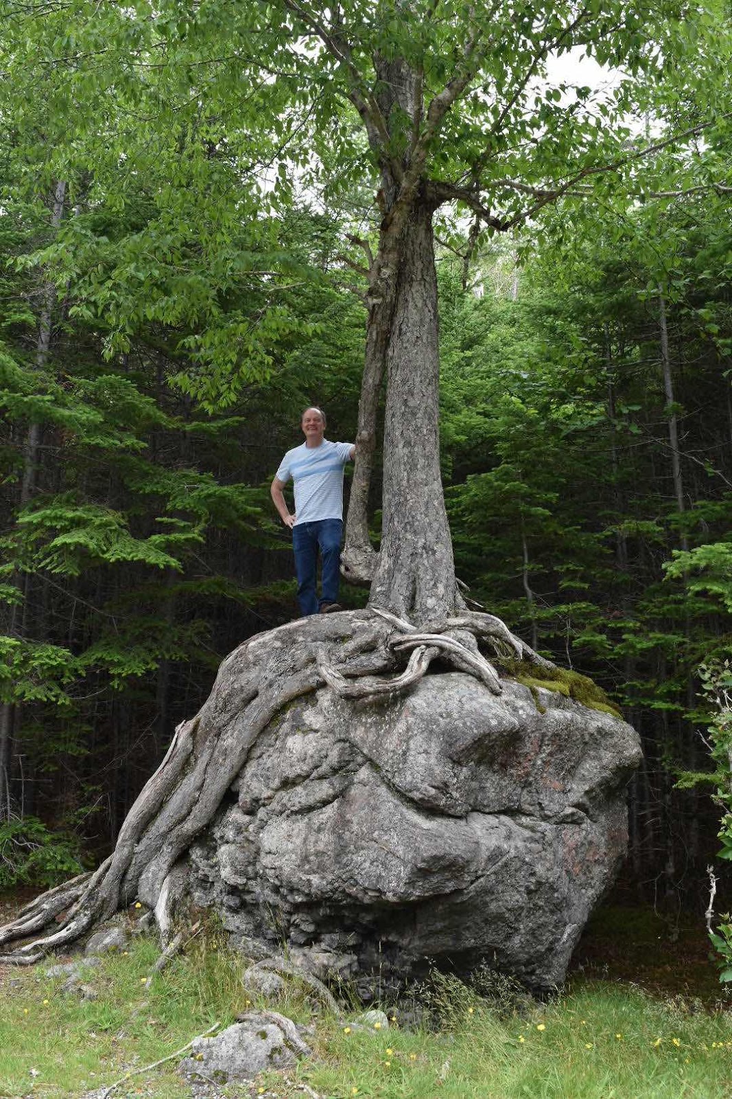
David has a photo of him standing on this same boulder in 1980, at age 13 - the last time he was here. Do you see a bespectacled old woman's image in the boulder and tree roots?

Crabbe’s River, one of the best salmon rivers on Newfoundland's West Coast.

We did veer off the Trans-Canada Highway to visit two clusters of villages. Not to try to put on holier-than-anyone airs, one of the village names caught David's attention for good reason!

A guy named Bob in the tiny village of Maidstone has a brilliant weather station!

In any other Province, a field like this would be reason to yawn. But in Newfoundland, the rocky soil makes such a field a rare commodity, except in and near the Codroy Valley, with its exceptionally fertile soil.

The MV Leif Erikson in port at Port aux Basques.
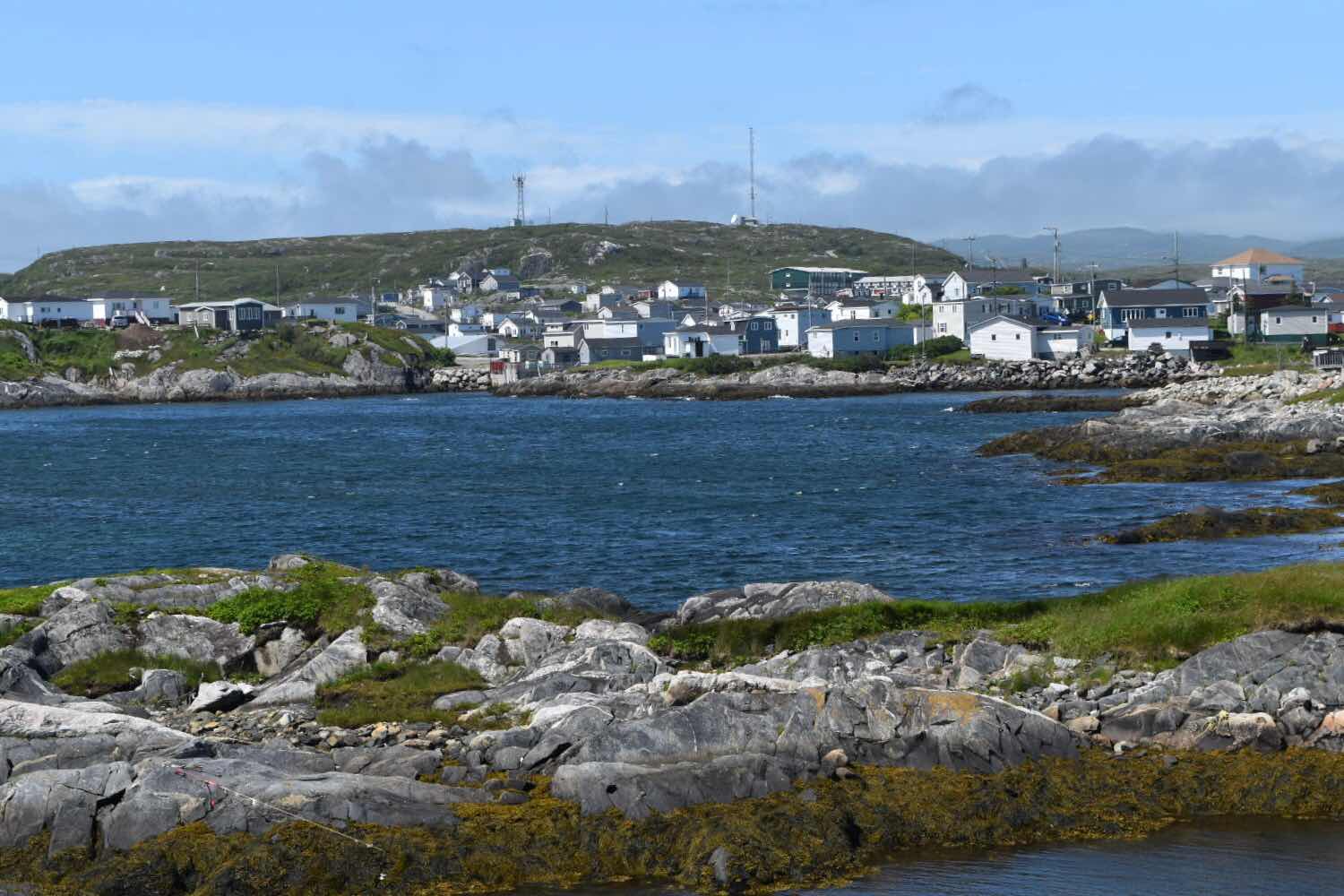
With a population of 4000 people, Port aux Basques surprised us with its barren beauty and the degree to which it is a commercial and service hub for this corner of Newfoundland.

The Boardwalk along Port aux Basque's waterfront.

A colourful marketplace and amphitheatre forms a focal point on the Port aux basques waterfront.
Channel Lighthouse.

The fog is never far away in Port aux Basques! But it certainly didn't impede our experience here.
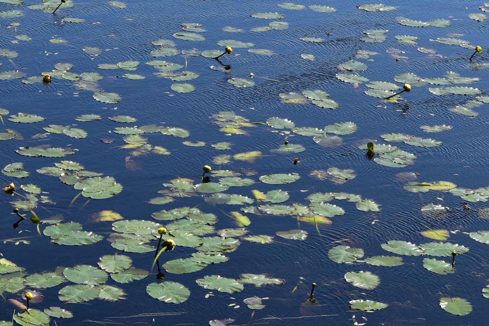
All along Route 470 there are ponds and ponds filled with waterlilies. And bogs and bogs filled with more Pitcher Plants (the bug-eating flower of Newfoundland) than we have ever beheld!


The tubular leaves at the base of the Pitcher Plant hold water, where insects drown; the plant then absorbs the insects' nutrients. In a rugged place like Newfoundland, there could be no better symbol of survival and resilience!

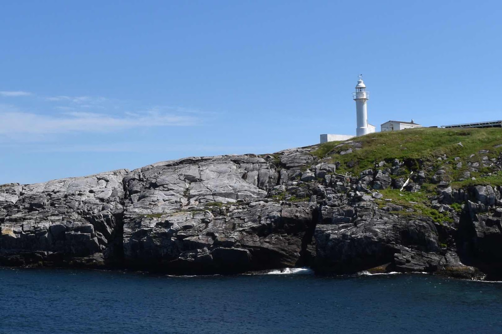
Near the end of Route 470 is what we came to see: the stunning fishing community of Rose Blanche.

Can you imagine living under a granite mountain like this?

Near the Rose Blanche Lighthouse, the gift shop / snack bar / entertainment stage are all ready to lure in the tourists (whose numbers are in short supply, due to a second COVID summer).

The shoreline leading to the Rose Blanche Lighthouse.

Irises are just one of many wild flower varieties along the walk to the lighthouse.

The lighthouse of Rose Blanche dates back to 1873 and had 5 light-keepers up to the time it ceased operating in the early 1960s. Stone lighthouses were rare in Newfoundland. A wonderful restoration job has made the lighthouse one of the most appealing (in our opinion) in Atlantic Canada.


Ye olde outhouse. (Rose Blanche Lighthouse.)

Just beyond Rose Blanche, Route 470 comes to a sweet end at Harbour Le Cou.


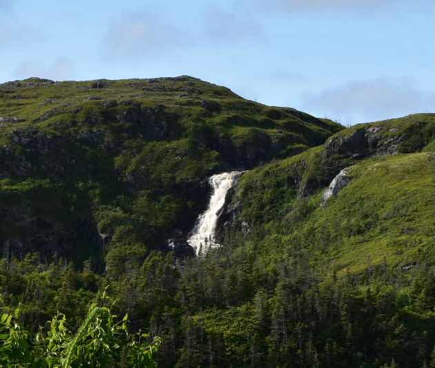
Two other items of note from our Route 470 experience: the granite cliffs of Diamond Cove (adjacent to Rose Blanche) are heavily laced with white quartz, perhaps contributing to the name of the cove? And Barachois Falls is a remarkable falls just west of Rose Blanche.

At 11:45 PM, MV Highlander, Marine Atlantic‘s newest ferry on the Cabot Strait run, started its voyage to North Sydney, passing directly in front of our hotel. A fitting end for a day in and around Newfoundland’s most important ferry town.


Comments
Post a Comment